 | |||
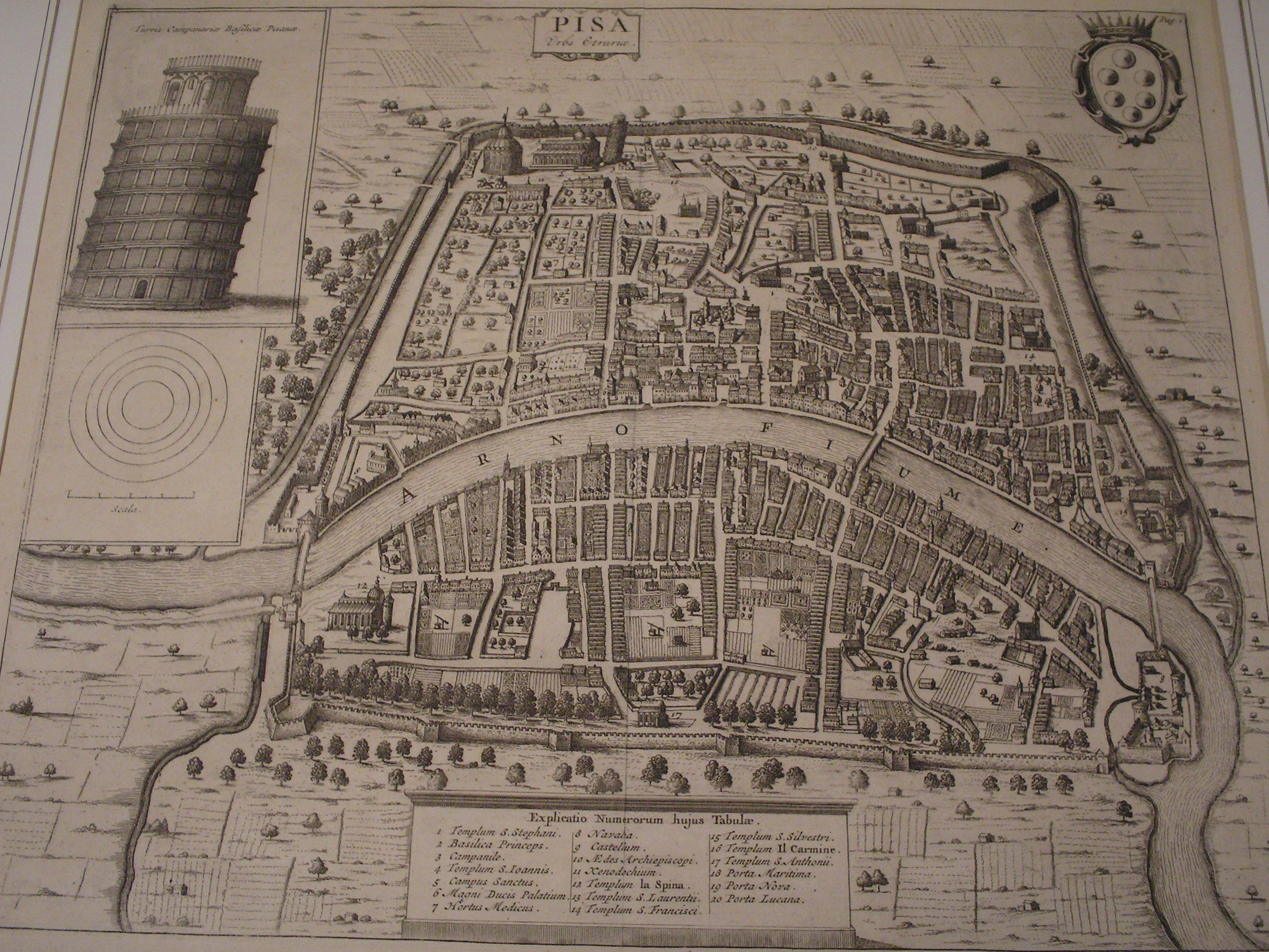
| Map of Ancient Pisa: Photo from Wikimedia - Public Domain |
Your map project will be due on Friday morning, first thing before we go geocaching! I look forward to seeing your maps of cities, villages, countries, ski hills, malls and/or schools. I'll ask you tomorrow which location you've decided to create a map for.
About symbols for maps: Your symbols could be for building types, physical or man-made features, size of cities, and any number of things. The idea is that the map will be a view from above. Don't forget scale - a hugely important feature on any map.
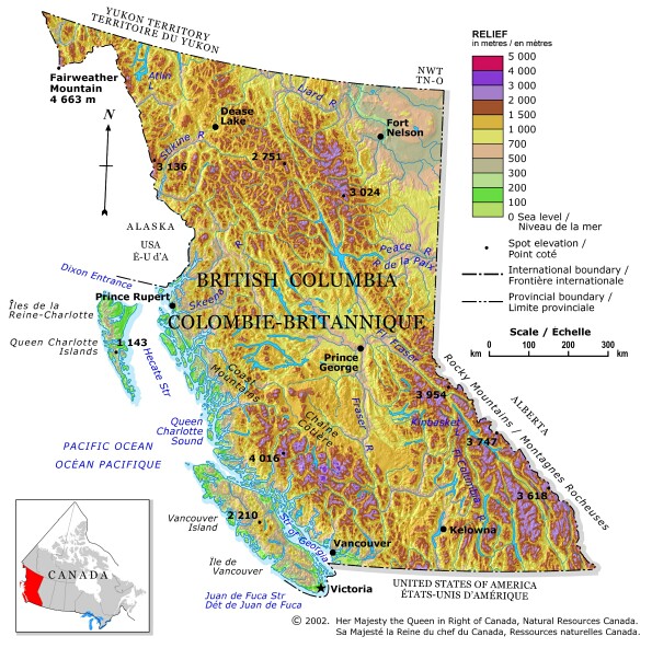
One of the maps you may have looked at today was an elevation map. If not, here is an example of an elevation map (sometimes called a topographical map). Look closely at the colour chart. Each color represents a certain height above sea level. Red is 5000 metres above sea level. Most of BC is yellows, so how high above sea level is that? How high are the purple sections? What level is Kamloops approximately?
Why would an elevation map or topographical map be useful? Who might use it? Is there a business or industry that needs this kind of information? Do satellites gather this kind of information and how do they do it? See if you can find answers to some of these questions!
No comments:
Post a Comment